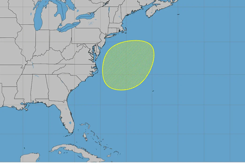
A slow-moving coastal storm is expected to bring high winds, flooding and dangerous surf to parts of the East Coast this week, with forecasters also monitoring the system for possible subtropical development.
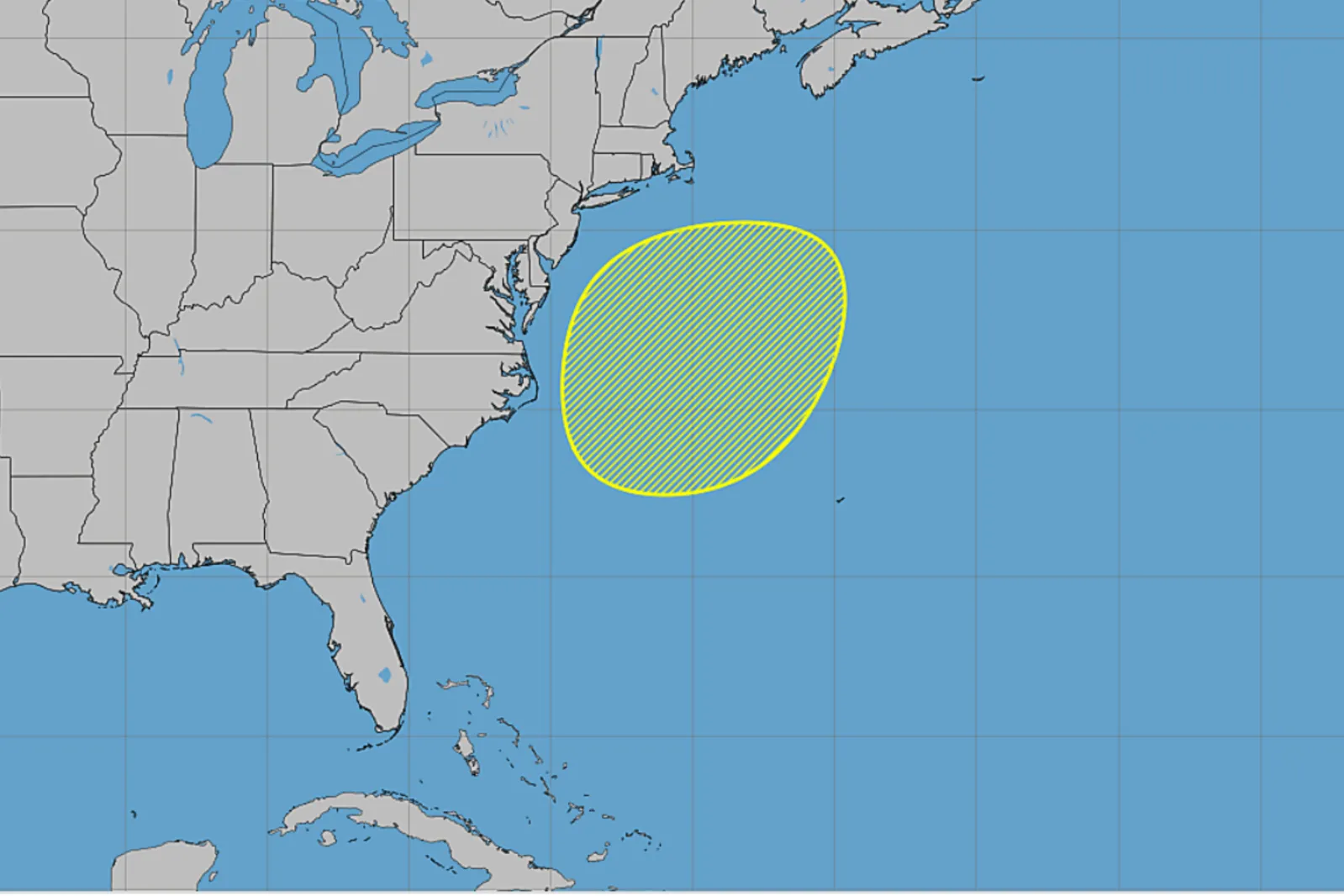
The National Hurricane Center (NHC) said Sunday that a storm-force non-tropical low was expected to form off the Southeast coast on Sunday or Sunday night and move “slowly and erratically” through the middle of the week. The agency gave the system a near-zero chance of development within 48 hours and a 30 percent chance within seven days.
“Regardless of development, this system will cause high winds, coastal flooding, and dangerous surf along portions of the U.S. East Coast,” the NHC said.
If it develops into a named subtropical or tropical storm, it would be called Josephine, according to the list of next named storms.
The possibility comes during an unusually quiet Atlantic hurricane season. Through October 18, the basin had produced nine named storms but only one hurricane, Isaias, which is currently the year’s only major Atlantic hurricane.
Forecasters say the storm does not need to become Josephine to produce significant coastal impacts.
“AccuWeather hurricane experts continue to monitor a medium risk for tropical or subtropical development off the East Coast between October 19th and October 23rd,” Alexander Duffus, a meteorologist for forecasting operations with AccuWeather, told Newsweek in an email Sunday.
Duffus added: “Regardless of if this will eventually be designated as a subtropical or tropical storm by the National Hurricane Center in the coming days, gusty winds, rough surf, beach erosion and coastal flooding can be expected for portions of the mid-Atlantic through early to the middle of this week.”
East Coast Threats
The most prolonged effects are expected from the Delmarva Peninsula into eastern North Carolina, with rain, gusty winds, beach erosion and coastal flooding among the threats, according to The Weather Channel. High surf and dangerous rip currents could extend much farther, from Florida to New England.
AccuWeather said the most significant coastal impacts could occur around the Outer Banks of North Carolina, southeastern Virginia and the beach communities of Maryland and Delaware.
“The coastal hazards risk at this time is greatest from coastal New Jersey to the Outer Banks of North Carolina through Tuesday,” Duffus said. “Very wind[y] conditions are expected with gusts from 40-60 mph that can blow around unsecured objects. Coastal flooding and beach erosion can also occur, especially during high tide cycles.
Coastal Flooding and Beach Erosion
The storm’s slow movement could prolong its effects on vulnerable beaches and coastal communities.
The Weather Channel reported that the system could remain offshore for days, producing high surf, rip currents, coastal flooding, rain and strong winds. The outlet said the storm was not expected to be as strong as the late-September nor’easter but could linger through much of the week.
AccuWeather similarly forecast long-duration gusty winds, beach erosion and tidal flooding, with the Outer Banks and southeastern Virginia potentially seeing greater impacts than areas farther north because of the storm’s expected position and duration.
The National Weather Service’s Eastern Region coastal hazard page showed a range of active coastal and marine hazards Sunday, including coastal flood, high surf and gale alerts in parts of the region.
Newsweek’s reporters and editors used Martyn, our AI assistant, to produce this story. Learn more about Martyn here. Contact Newsweek editors for this story: Steve Mollman and Anthony Murray.